I am currently working on a small scientific film that will use Sentinel-2-data. Doing so, I encountered two issues. Do you have ideas how to fix them? I am grateful for every hint
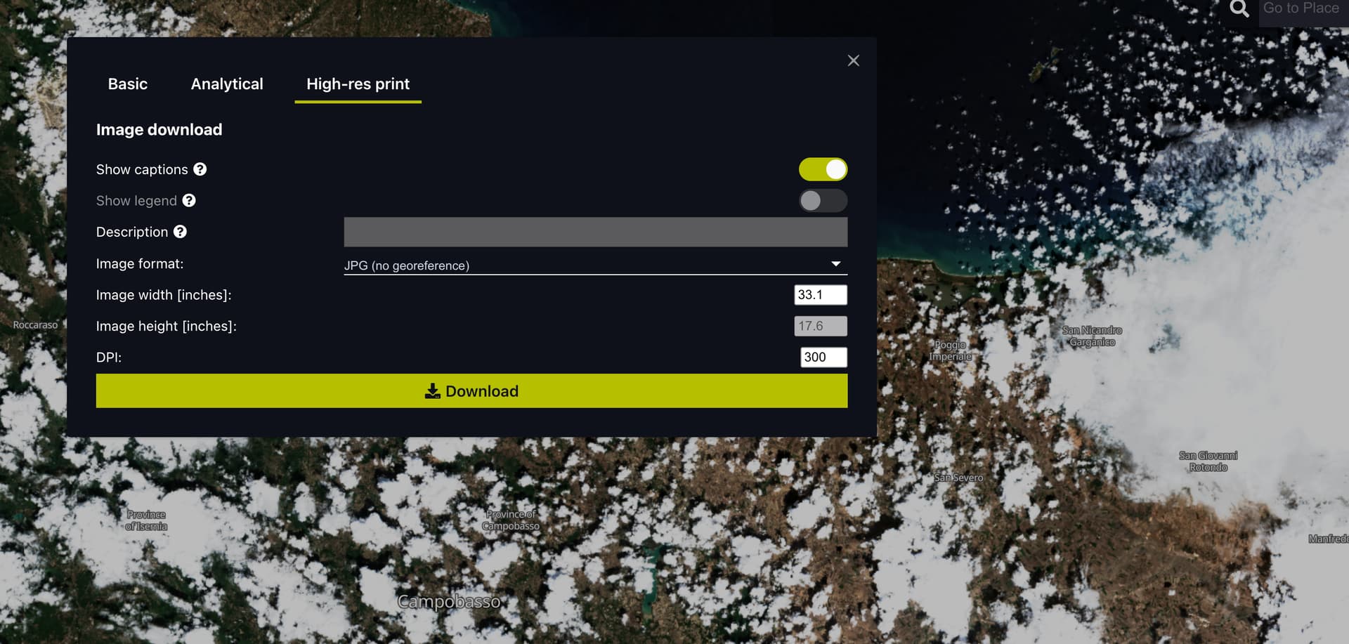
Unfortunately, the resolution of the images you can download from Sentinel Hub is even at the highest level (2500 x 1346 pixels) too low for our film. We would need PNG or JPG files with at least 4000 x 4000 pixels resolution. Is there a way to obtain the data in such a high resolution?
In the film we would like to gradually zoom in from a global scene from Sentinel-2 data onto a local scene in the Baltic Sea. Is it possible to get such a global picture from Sentinel-2 data? Up to now, I was only able to download small, local, and spatially limited images from the EO browser as well as from the corresponding Sentinel Hub-WMS in QGIS and ArcGIS.
As you may or may not know Sentinel-2 data is 10m resolution. This means that when you zoom into local areas the imagery will become blurry and pixellated because of its limited resolution. To solve this problem, you can use commercial data that goes down to sub metre resolution but this would be an additional cost to order and then use.
For imagery that covers the whole globe I would recommend using Sentinel-3 which is a much lower resolution satellite but the data will be much more manageable on a global scale. I think I understand what you are trying to achieve technically, but if you can break it down into smaller simpler problems that may help us solve the issue.