I’m trying to access Airbus Pleaides imagery for a few polygons we have in Venezuela using the EO Browser, but every polygon I add to the search bar results in no image found for the last 6 months. I tried changing the process level, toying around with the incidence angle and, cloud and snow coverage, but nothing changes.
Is it normal that there are places without images for such a long time?
This can be quite normal. Because Airbus Pleiades imagery is a very high resolution sensor and has a limited swath width, the constellation is unable to cover the same amount of area as Sentinel-2 does for instance.
Naturally, acquisitions are focussed on areas of the world that are more populated and potentially of interest to buyers of satellite imagery. So in your areas of interest there may not be any Pleiades imagery acquired in the last 6 months.
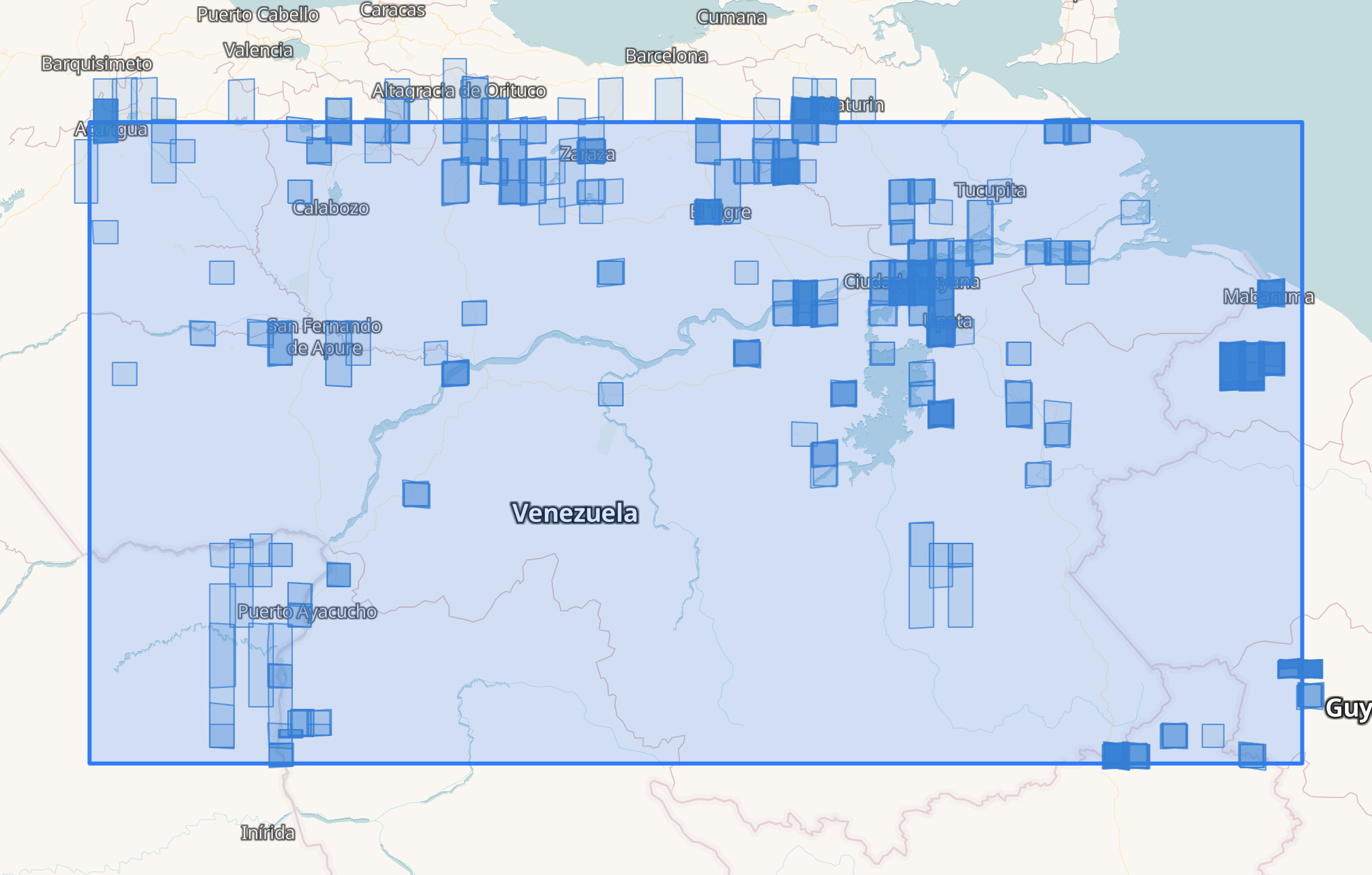
I also tried a search over a large area of Venezuela for Airbus Pleiades imagery for the las 6 months. As you can see, the image coverage of the AOI is very limited and mostly around urban areas.
If you are looking for more complete coverage you may want to either increase your time range, and to also search for images from other constellations such as Maxar and PlanetScope.
To use VHR data (Airbus or Maxar) for monitoring, you would need to create a tasking order. However, tasking is quite a bit expensive due to minimum order sizes (i.e. 100 km2 of homogenous area per order), so not really feasible for agriculture.
For systematic monitoring Sentinel and PlanetScope is the best option.