Hi all,
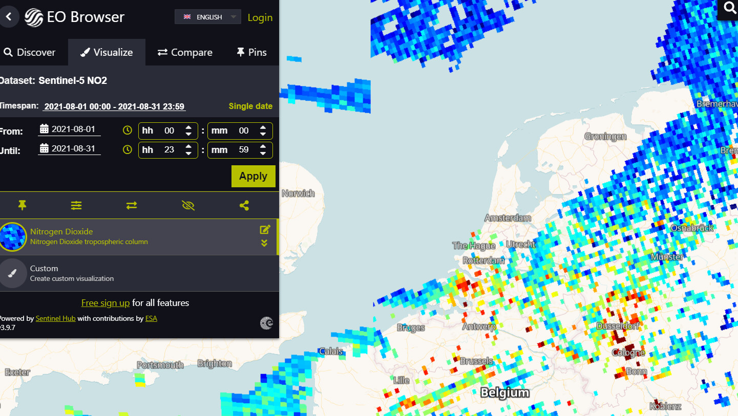
I am relatively new to using the Sentinelhub API and am having issues with receiving S5p NO2 data. I have a list of point coordinates which I iteratively (not so neatly) convert to a rough Bbox with a certain buffer size. Based on this BBox I should receive an image of the NO2 values in that area, but whereever I try to do this I always get only zeros, also in the dataMask. So this tells me the data is not available, but I find that hard to believe given the sheer size of the request and the time_frame which can be up to a year. Is there something wrong with my request? See the code below.
Note that I can choose between S2L1 and S5p. S2L1 works fine.
from sentinelhub import DataCollection
from sentinelhub import SHConfig, BBox, CRS, SentinelHubRequest, MimeType, bbox_to_dimensions
import matplotlib.pyplot as plt
import numpy as np
import os
import pandas as pd
import h5py
import datetime


# Define parameters
MAIN_FOLDER = os.getcwd()
input_path = os.path.join(MAIN_FOLDER, 'Data')
output_path = os.path.join(MAIN_FOLDER, 'Data')
if not os.path.exists(output_path):
    os.makedirs(output_path)

csv_file_name = 'df_weekly_august.csv'
satellite_type = 'S5p' # S5p
if satellite_type == 'S2A':
    time_interval = ('2021-08-01', '2021-08-31')
    buffer = 1200 # in meters

elif satellite_type == 'S5p': # Need to get data for every day within this time_interval
    time_interval = ('2021-08-01', '2021-08-31')
    buffer = 20000 # in meters

# !!! Ideally this part would create a 1200 m directly around the point instead of
#  using coordinates to do that !!!
crs = CRS.WGS84
# Approximation WGS84
# 1 degree of latitude corresponds to 111km
# 1 degree of longitude corresponds to 73km
long_adj = (buffer/67000)/2
lat_adj = (buffer/112000)/2

resolution = 10 # 10m resolution is used in paper

# Configure login details
config = SHConfig()
config.instance_id='11d91198-MASKED'
config.sh_client_id='be4369f0-MASKED'
config.sh_client_secret='#Vtzd8)-MASKED'

if config.sh_client_id == '' or config.sh_client_secret == '':
    print("Warning! To use Sentinel Hub services, please provide the credentials (client ID and client secret).")


#%%

# https://apps.sentinel-hub.com/requests-builder/
if satellite_type == 'S2A':
    dataCollectionType = DataCollection.SENTINEL2_L1C
    evalscript = """
    //VERSION=3
    function setup() {
        return {
            input: [{
                bands: ["B01","B02","B03","B04","B05","B06","B07","B08","B8A","B09","B10","B11","B12","CLM"],
                units: "DN"
            }],
            output: {
                bands: 14,
                sampleType: "FLOAT32"
            }
        };
    }

    function evaluatePixel(sample) {
        if (sample.CLM == 1) {
            return [sample.B01,
                    sample.B02+1000,
                    sample.B03,
                    sample.B04,
                    sample.B05,
                    sample.B06,
                    sample.B07,
                    sample.B08,
                    sample.B8A,
                    sample.B09,
                    sample.B10,
                    sample.B11,
                    sample.B12,
                    sample.CLM];
         }
        return [sample.B01,
                sample.B02,
                sample.B03,
                sample.B04,
                sample.B05,
                sample.B06,
                sample.B07,
                sample.B08,
                sample.B8A,
                sample.B09,
                sample.B10,
                sample.B11,
                sample.B12,
                sample.CLM];
    }


"""


elif satellite_type == 'S5p':
    dataCollectionType = DataCollection.SENTINEL5P
    evalscript = """
    //VERSION=3
    function setup() {
      return {
        input: [
          {
            bands: ["NO2", "dataMask"],
          }
        ],
        output: [
          {
            bands: 2,
            sampleType: "FLOAT32",
          },
        ],
      };
    }


    function evaluatePixel(sample) {
        if (sample.dataMask == 1) {
        return [sample.NO2];
        }
    }

    """

else:
    raise Warning("Only S2A and S5p are currently available")


groundstation_df = pd.read_csv(os.path.join(input_path, csv_file_name), index_col=None, header=0)

sentinel_paths = []
for index, row in groundstation_df.iterrows():
    ID = index #row['StationLocalId']
    print(ID)
    lat, long = row['latitude'], row['longitude'] #row['SamplingPoint_Latitude'], row['SamplingPoint_Longitude']
    print(lat, long)

    bbox = BBox( ((long-long_adj,lat-lat_adj), (long+long_adj, lat+lat_adj)), crs)
    bbox_size = bbox_to_dimensions(bbox, resolution=resolution)

    if satellite_type == 'S2A':
        request = SentinelHubRequest(
            evalscript=evalscript,
            input_data=[
                SentinelHubRequest.input_data(
                    data_collection=dataCollectionType,
                    time_interval=time_interval,
                    mosaicking_order='leastCC',
                    other_args={'processing': {'upsampling': 'BILINEAR'}},

            )],
            responses=[
                SentinelHubRequest.output_response('default', MimeType.TIFF)
            ],
            bbox=bbox,
            size=bbox_size,
            config=config
        )
    elif satellite_type == 'S5p':
        request = SentinelHubRequest(
            evalscript=evalscript,
            input_data=[
                SentinelHubRequest.input_data(
                    data_collection=dataCollectionType,
                    time_interval=time_interval,
                    #mosaicking_order='mostRecent',
                    other_args={'processing': {'upsampling': 'BILINEAR', \
                                               'minQa':'75', \
                                               'timeliness': 'NRTI'}, }, # minQa 75 is used in paper

            )],
            responses=[
                SentinelHubRequest.output_response('default', MimeType.TIFF)
            ],
            bbox=bbox,
            size=bbox_size,
            config=config
        )

    image = request.get_data()[0]

    if satellite_type == 'S2A':
        plt.figure()
        plt.imshow(image[:,:,[1,2,3]]/10000)
    elif satellite_type == 'S5p':
        plt.figure()
        plt.imshow(image[:,:,1])