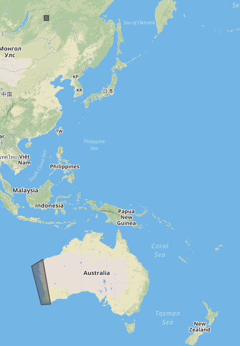
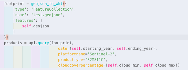
Hi! I have problem with your API. In some cases when i searching for satellites images by geojson polygon through your api. I getting images outside of my polygon, like in attachment. Square polygon - images returned by api. Polygon nearby Australia - polygon for searching in API request
This TIF does seem to be reprocessed as the tile name is not in line with any of the standard ones, known to me.
I am assuming that you either downloaded original product from OpenHub or band tiles from AWS and then you renamed them.
In both of these options the meta-data of the files themselves is handled by Copernicus so we can unfortunately not do anything about it. I suggest you contact EO Support (eosupport@copernicus.esa.int).
The API response however, what has started this discussion, seems to be working OK.