I have the next doubt, in the docs it is said for BBOX one must give the four coordinates representing the top-left and bottom-right of the bounding box and must be separated by commas. Required. Example: BBOX=-13152499,4038942,-13115771,4020692. And that the GEOMETRY must be WKT, WKB, or a list of coordinate pairs representing a polygon (pairs separated by semicolons, components by comma, i.e. 1,1;2,2;…) .
The thing is that it does not specifies order of XY coordinates, I mean must use long, lat pairs or lat, long? also when I use the formats stated above the WMS query fails and it only works if I use top-right and bottom-left corners for BBOX as “LAT,LON,LAT,LON” and for GEOMETRY I must give something like this “POLYGON((LAT LON, LAT LON, LAT LON, LAT LON, LAT LON, ))” those formats are stated in the FAQ section too.
So my main questions is which is the right way to do dose queries?
About 5 years later I stumble upon this. I used the example here: https://docs.sentinel-hub.com/api/latest/data/sentinel-2-l2a/examples/, and I was wondering what lines of latitude/longitude the “bbox” array had. After 20 minutes of testing by increasing the size of the bounding and getting an image returned large enough to see where on earth the pic was (France), it turns out the example bbox ordered as long, lat, long, lat.
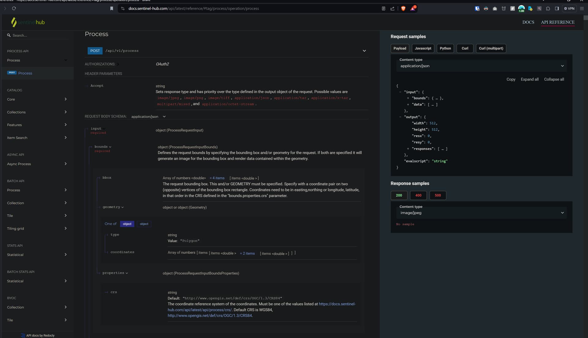
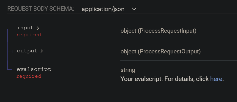
I wish that page I mentioned the order I found out. And that the API reference for the process API mentioned how to find it. The center of this picture shows the bbox parameter being insufficiently documented:
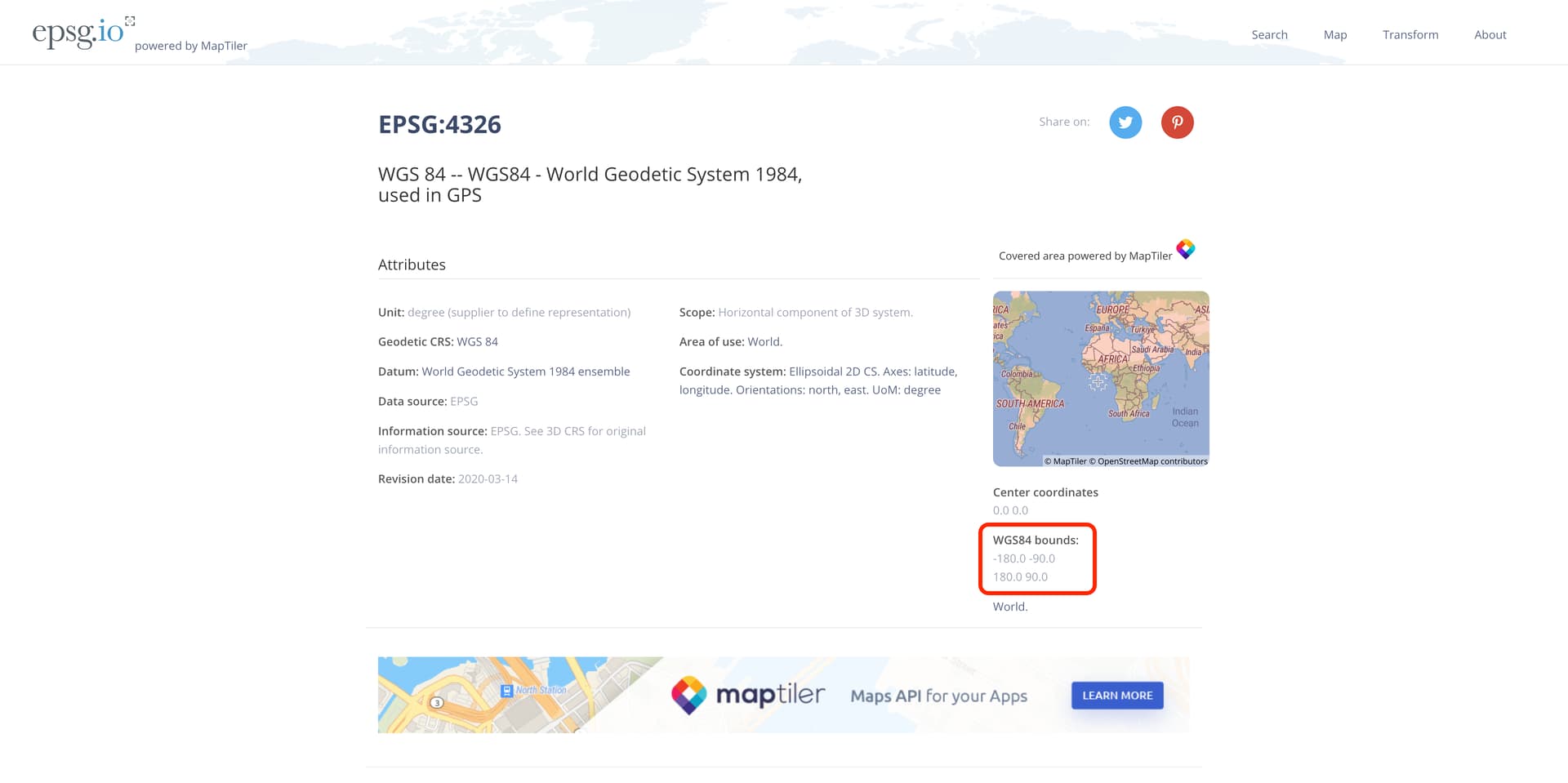
@gmilcinski@chung.horng any idea? Not important for me since I am using CRS84 and figured that out. But curious how one would find the order meaning for other CRS’s.
Hmm, that is vague…just says WGS bounds. Just some numbers without being labelled longitude or latitude. Wish the sentinel api reference I linked above linked to that website and said to follow the order of the bounds.
You then click on “input” to expand it. Then expand “bounds” and the bbox parameter will be shown. The bbox parameter should also be explained fully on this page that is linked next to the “evalscript” parameter: https://docs.sentinel-hub.com/api/latest/evalscript/v3/