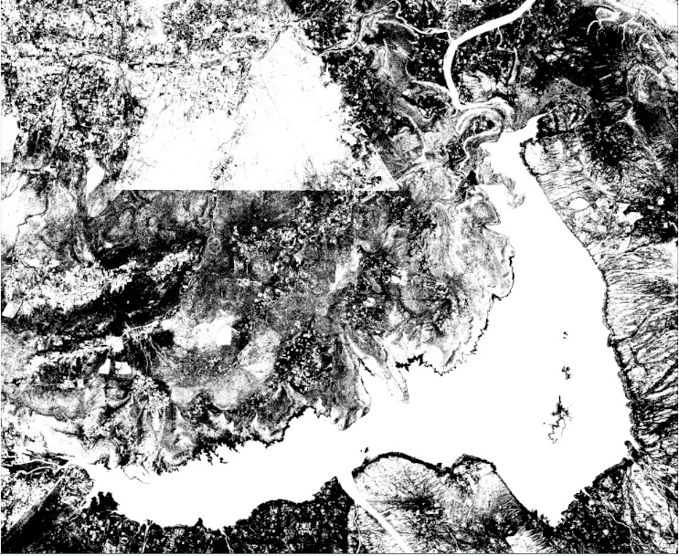
After exploring BlueDot Water Observatory Backend code ,I have tried some simple steps on different resolution satellite images. One of NDWI input:-
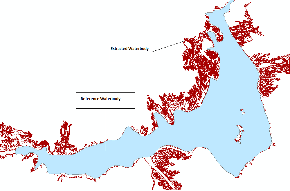
Somehow I was able to extract the water body from the given satellite image(5m res).But the water body result I am getting is connected with lots of unwanted stream .I want to clip those streams from main water body area. My output is like this:
And in Blue Dot Observatory ,the streams are clipped off at some extent. Like shown in this example:
I want to know on which basis it is decided where to clip off the streams?
Hi @mansimittal06,
the following steps in the water observatory’s water-extraction process can clip off the water extent:
- Region Of Interest (ROI):
- the ROI is defined as a bounding box around the nominal water extent. The region is inflated by certain amount to include the surrounding of the water body, but sometimes it happens that due to obsolete nominal water extent polygon (being too small) or extreme flooding the region that is analyzed is too small. This can lead to straight edges in the extracted water extent polygons.
- Application of Digital Elevation Model (DEM) veto:
- in order to reduce false positive water detections due to topographic shadow a simple veto based on DEM data is applied. I believe this is the case for the Periyar Lake shown in your post. In the case of Periyar Lake it looks like that the application of DEM veto is not necessary at all or at least it should be modified. Unfortunately, this part of the water extraction procedure is difficult to generalize well over many water bodies.
- Simplification of geometry
- At the end of the process the extracted water polygon is simplified in order to reduce the number of points. This has however a small impact.
Thank you for the guidance.Can you please explain Region of Interest point in more detail?I am unable to understand from here
Region of interest is defined as a bounding box around the water body’s nominal water extent. The bounding box is inflated (if I remember by 10%) in order to include some surrounding land. The water extraction algorithm is then executed on a raster NDWI image for this bounding box. This means that only water within the BBOX can be detected.