Cloud cover percentage of Sentinel2 L1C

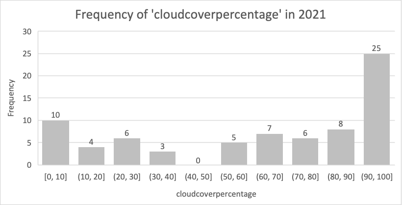
Hi there, the following graph shows the frequency of cloud percentage of a Sentinel-2 L1C tile in 2021, and it seems like only 10 dates have cloudcover less than 10%. I am wondering:

1, How much percentage of cloudcover is considered as “good quality” or “clear” for calculating NDVI directly? If it’s 10%, then there are actually only a few images that can be used.

2, For those images with a high cloudcover percentage, how could we do the “cloud masking” to get rid of the cloud effect using QGIS plugins (or python packages)?

Hi @yongyu ,

  1. There may not be a concrete definition for a “good quality” regarding cloud coverage. It depends on how you’re going to use the data. One thing I’d like to point out is that the cloud coverage info in the metadata is the cloud coverage for the tile. That is to say, there is still a tiny chance that your area of interest is covered by cloud in a tile with 10% cloud coverage and vice versa.

  2. With Sentinel Hub you can apply the CLM band in the evalscript and mask cloudy pixels. There is also a Sentinel Hub Cloud Detector – s2cloudless available through sentinelhub-py that allows you to deal with cloud.

Best Regards