Hi.
i downloaded Copernicus 30m DEM data from AWS and compared it to SRTM, Lidar and Tandem-x products, all resampled to 10m resolution. It seems as if the height information is shifted compared to these other datasets.
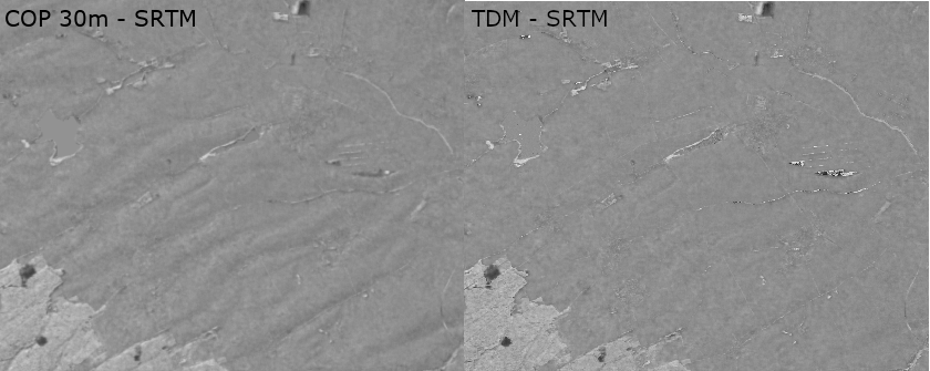
For better visibility, i’ve taken the difference of the DEMs in the following:
The difference for example between TDM and SRTM (right image) in most lightly vegetated areas is very small, and does not show much of a regular pattern.
Thanks for the response!
I redownloaded and compared the raw and unresampled data, no shift visible between SRTM and Copernicus DEM, so the error must be on my side.
Just a clarification for the upper image: the meadow and agricultural areas shown should have not much of a change over the years. The difference therefore should be mostly random. In the right image, this is mostly the case with uniform grey values. The left image has bright and darker sides, following the relief. So one if the data inputs is shifted to north-west compared to the other.