Hello
I’m a new user and I’m very impressed by the quality of the satellite pictures shown, It allows me to have a precise view of the snow covering of mountains to prepare back country skiing. Unfortunately, I have a lot of difficulties to superpose the satellite picture with the background map : the map only appears during 0,5s an then the picture displays above.
Is there a way to go quickly from map to satellite picture and vice versa ? Or to decrease/increase the intensity of the satellite picture layer ?
Thank you for your answer.
Dear @les.hamelin
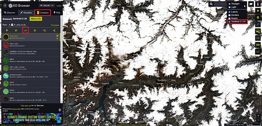
I assume you are using EO Browser to display images. The best option for your use case is the “Compare mode”. To use it:
- Add a visualization to compare (bottom left button on the screenshot)
- Switch to the compare tab (top left button marked on the screenshot)
- Switch mode from split to opacity
- Use the slider to change the opacity of the overlaying satellite image (basemap is underlaid beneath)
For more infos on EO Browser and the compare mode I recommend you to check out our Sentinel Hub EO Browser webinar.
Best,
Daniel
PS: You can also turn of a layer via the layer list in the top right corner (screenshot)
Thank you very much Daniel for your very quick and very precise answer. It’s exactly what I wanted !!
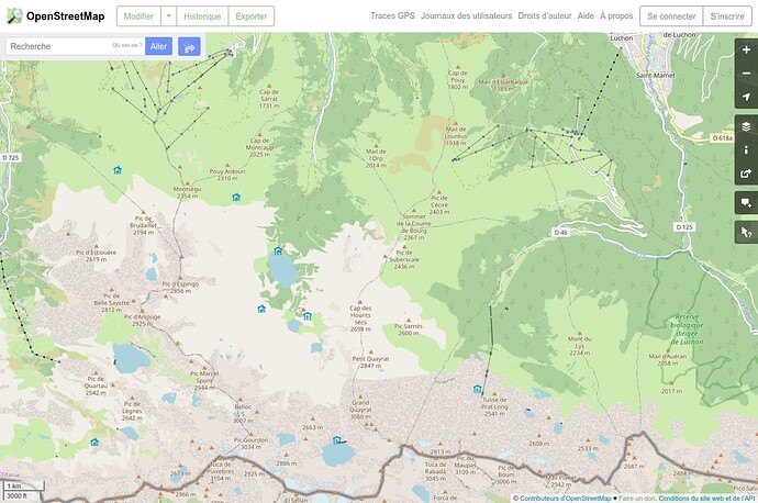
In fact, one friend gave me the link for sentinelhub play ground and, with this viewer it was impossible for me to do it. However this viewer has (in my opinion) a much better bakground map. Do you know if it is possible to use this background map with EO browser ?
Best
Olivier
Dear @les.hamelin,
from the data background maps are relatively similar as they are both based on OpenStreetMap. You have different styling options of tweaking the background map visualization and selecting a different style in the top right corner (see previous screenshot).
Best,
Daniel
Dear Daniel
Thank you for your answer. In the right top corner it’s good to see road, labels and frontiers. Nice !
The EO browser is very good to visualize impressive landscape satellite pictures, but if I may suggest something to persons in charge, it could be better to use this background map (anyway for backcountry skiing because summits and hiking trails appears )
Best regards.
Olivier
Has Sentinel-hub started a conversation to bring its real time satellite view of earth with CALTOPO’s mapping software?
Hi David,
we are not disclosing our customers, so we cannot comment on this topic. I suggest you contact CALTOPO team and ask them about this feature.
Best,
Grega
Hi Grega,
As luck would have it, Caltopo did respond to a similar inquiry, and they showed me where the Sentinal hub data is located on their site. So it looks like they have licensed your product and for the pro users of Caltopo, have access to sentinal hub data… This is just what I was hoping for, as I can see routes that I intend to travel and the conditions real time, and history. Thank you.
A post was merged into an existing topic: Overlay of gps or klm route?

