FAPAR not available for an area

We have recently tried to download FAPAR and NDVI index for an area in Uttar Pradesh Delhi (80.139647,
27.422062,
80.188082,
27.456188) on 18th April. For the same date, NDVI is available but, FAPAR is not. In fact all other vegetation and soil based indices are available.
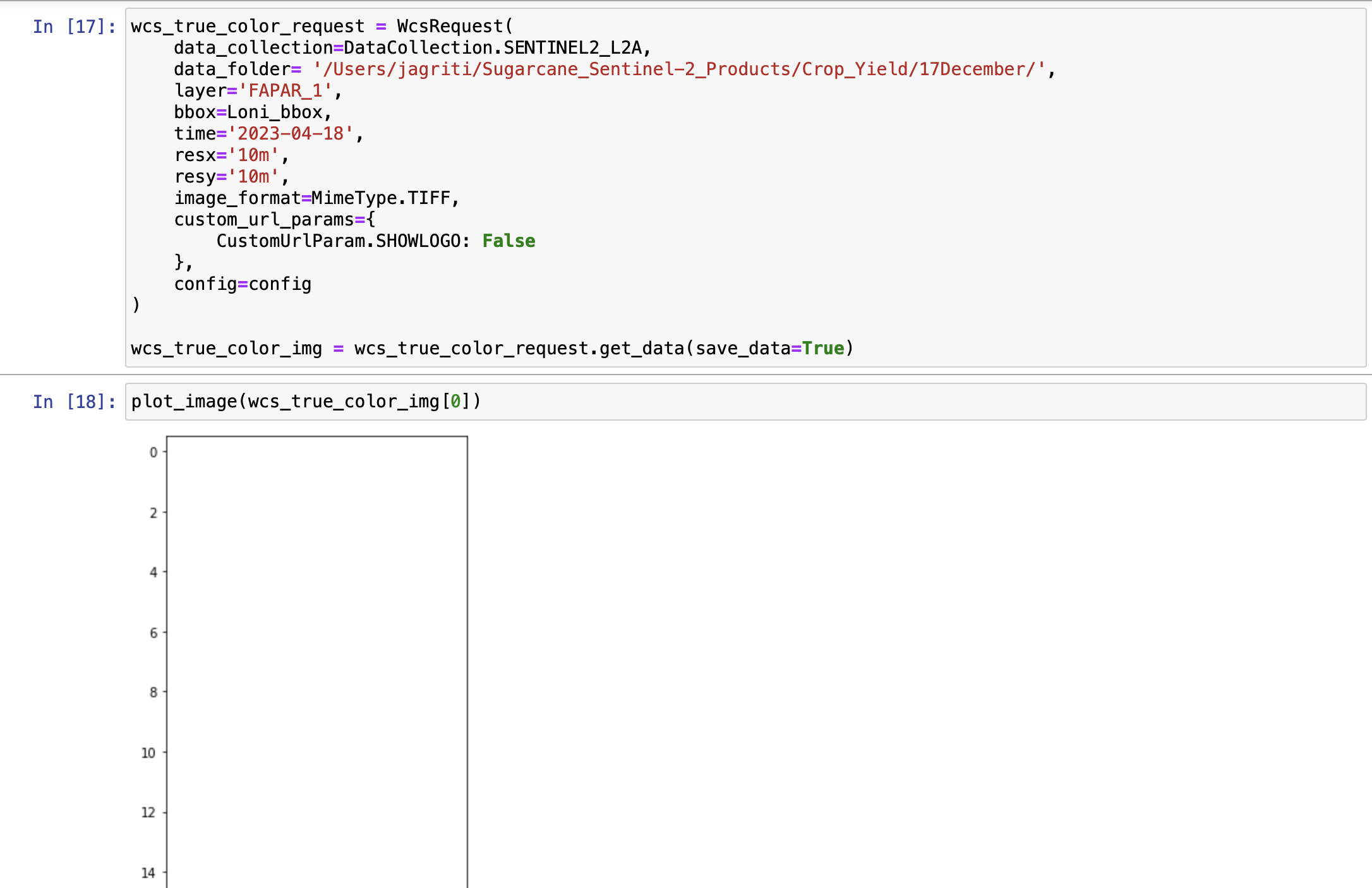
We tried to fetch the dates via Catalog API as well and it mentions that the data is available on 18th April for this area. After the data download, we could see only Nan value for FAPAR while every other Index is available.
Could you please clarify if sentinel 2B is capturing the data on the said data on a given area, how come FAPAR is not available but rest all other indices and data bands are there.

Thanks

HI,

Thanks for the question. I don’y understand how you are using Catalog API to search for your desired data. Are you searching the Sentinel-2 L2A data collection?

In addition, how are you trying to access the FAPAR product? Are you generating this from the Sentinel-2 data collection or are you obtaining it from the Vegetation Indices data collection available through the Copernicus Land Cover Service?

Hi William,

thanks for the quick response.

We are downloading FAPAR through custom sentinel hub script available on the website. It runs perfect on all the areas and dates. We use WCS request.

Except for this area which I have mentioned.(80.139647,
27.422062,
80.188082,
27.456188).

For this particular date (18th April 2023), FAPAR is not available, but rest other indices are there. I am attaching a screenshot for your reference.

Please can you provide a link to the custom script you are referring to please. In addition, are you able to provide the full request that you are using.

Sure,

Here is the link for FAPAR evalscript
FAPAR (The Fraction of Absorbed Photosynthetically Active Radiation) | Sentinel Hub custom scripts

Here are the screenshots for the WCS request and data we are generating.

extent: 80.1668642000000062,27.4539435000000012, 80.1678813000000048,27.4554019999999994

Loni_extent = [80.1668642000000062,27.4539435000000012, 80.1678813000000048,27.4554019999999994]
Loni_bbox = BBox(bbox=Loni_extent, crs=CRS.WGS84)
Loni_bbox
print(Loni_bbox)

wcs_true_color_request = WcsRequest(
data_collection=DataCollection.SENTINEL2_L2A,
data_folder= ‘/Users/jagriti/Sugarcane_Sentinel-2_Products/Crop_Yield/17December/’,
layer=‘FAPAR_1’,
bbox=Loni_bbox,
time=‘2023-04-18’,
resx=‘10m’,
resy=‘10m’,
image_format=MimeType.TIFF,
custom_url_params={
CustomUrlParam.SHOWLOGO: False
},
config=config
)

wcs_true_color_img = wcs_true_color_request.get_data(save_data=True)


Hi William,

Could you see this error?

Hi,

Looking into this further, there is no FAPAR data available here. This is due to the algorithm using the following bands:

"viewZenithMean",
"viewAzimuthMean",
"sunZenithAngles",
"sunAzimuthAngles"

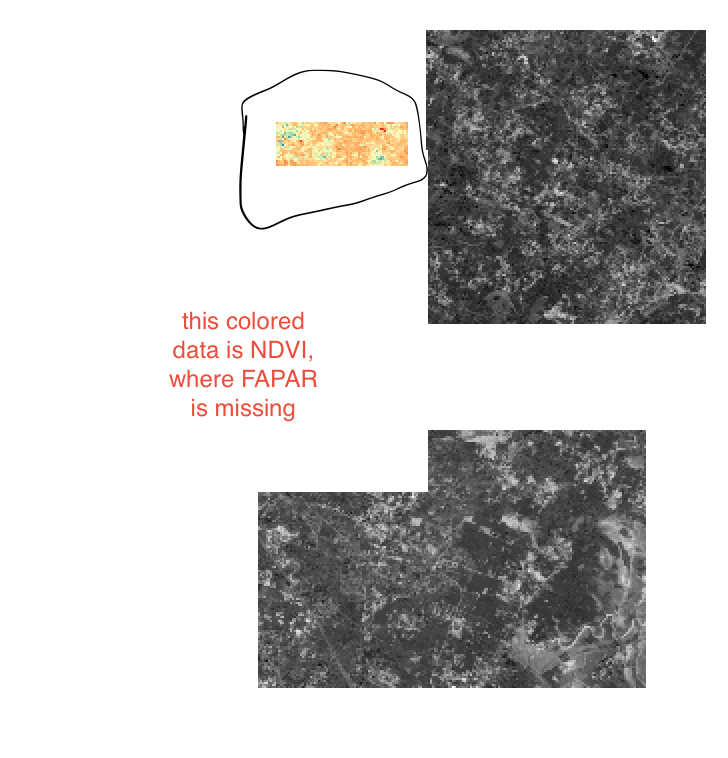
Because of their very low resolution, this means that calculating FAPAR on the edge of Sentinel-2 L2A tiles is not possible. In the screenshot below, you can see you AOI north of Hardoi is right on the edge of the Sentinel-2 L2A tile. You can obtain NDVI because it uses 10m and 20m bands, however, the before mentioned bands are 5000m in resolution.

Hope that this information helps you out.

what could be option in this case to estimate FAPAR for this date then? or we should change the date ?

Is there any other way to access these products via sentinel hub OGC API?

It would not be possible for that area of interest and that date. However, there is an image available on 16th April 2023.

This topic was automatically closed 60 days after the last reply. New replies are no longer allowed.