Service consumption to create the web platform
• Monitoring of pests, agro-climate and crop phenomenology
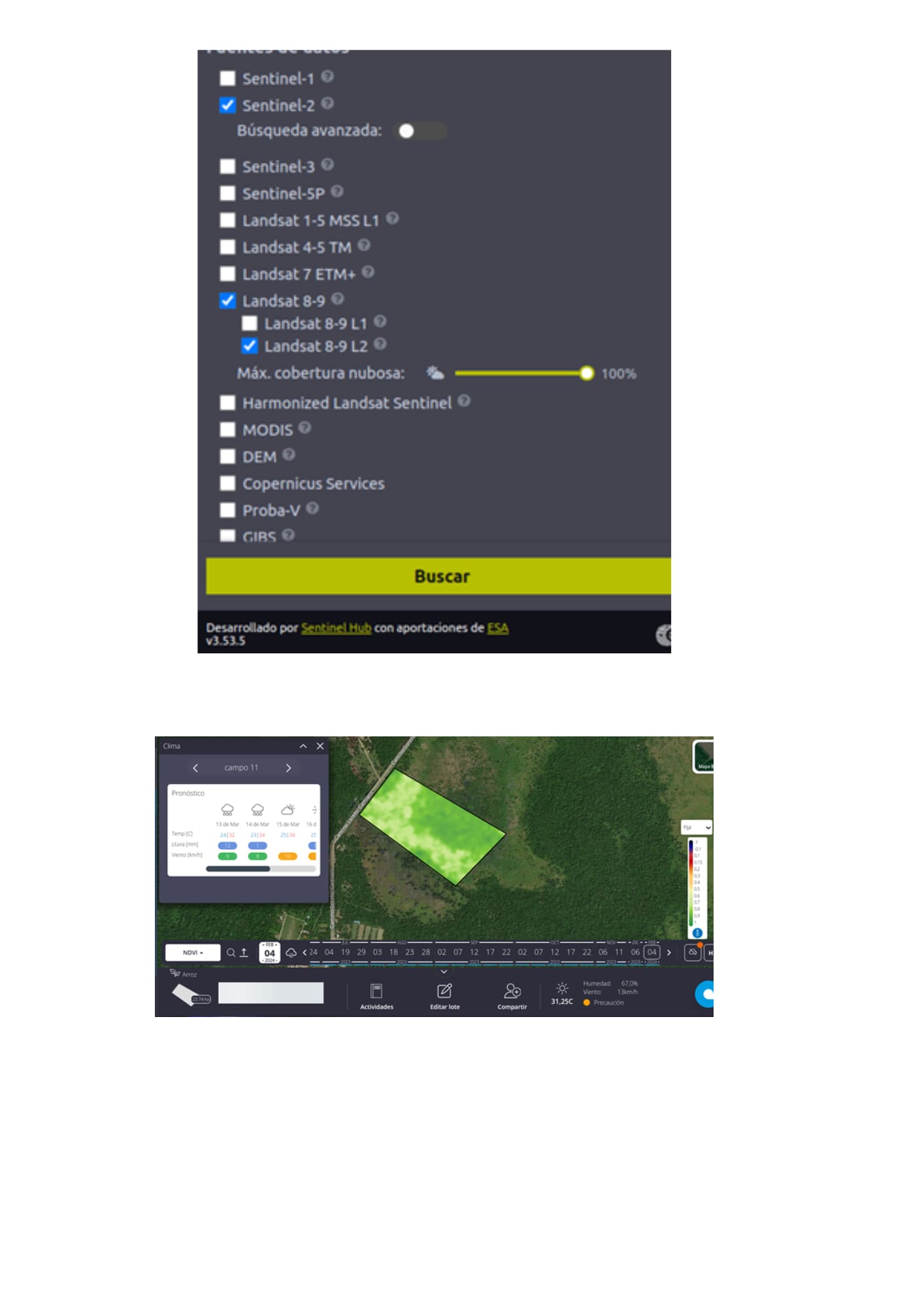
• Provide satellite images with 10m resolution and update them every 5 days (temporal resolution)
• Provide satellite images with a resolution of 3.7 meters that are updated daily (temporal resolution 1 day)
• Meteorological data for optimal monitoring of agricultural plots (polygons)
• Provide time series of crop phenology development
• Current weather data of agricultural plots (temperature, wind, humidity, clouds and precipitation)
• Sentinal 2 with a maximum of 50% cloud cover
• Landsat 8 with a maximum cloud cover of 50%
• Spectral indices for the analysis of crop phenology, NDVI, NDRE, MSAVI, RECI, NDMI.
• Masks to clouds and bodies of water in satellite images
• Planet with spatial resolution of 3 meters
• Time series of NDVI index throughout the agricultural season
• Accumulated Precipitation Graphs
• Maximum and minimum temperature graphs
• Weather forecast (access to information for the next 14 days)
• Vegetation map of any plot
• Productivity maps of any plot
All this information is required as services and we could consume these to be able to view it on our web platform initially.
For agricultural monitoring, there are more than 60,000 hectares for study.