Hi there,
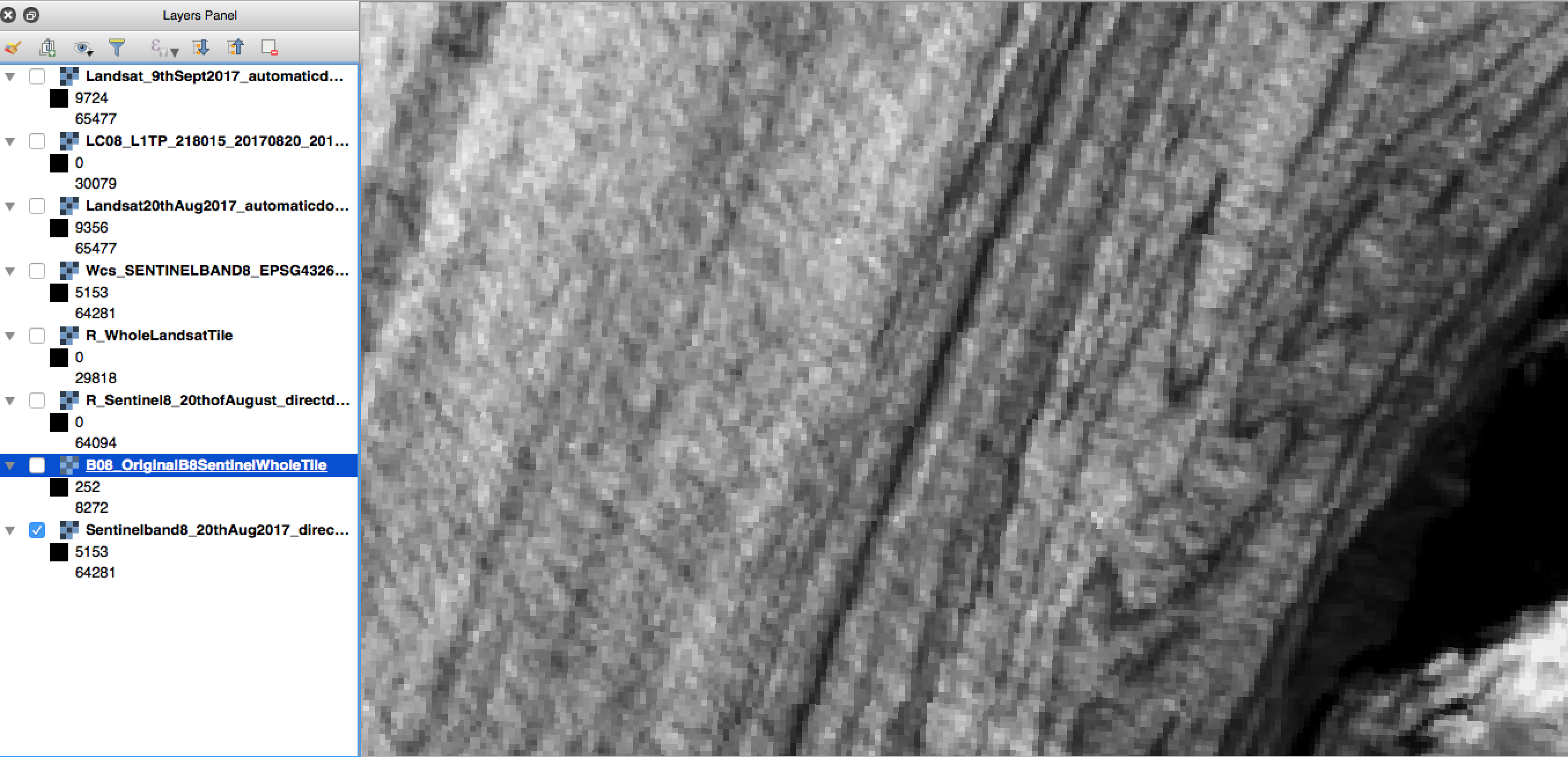
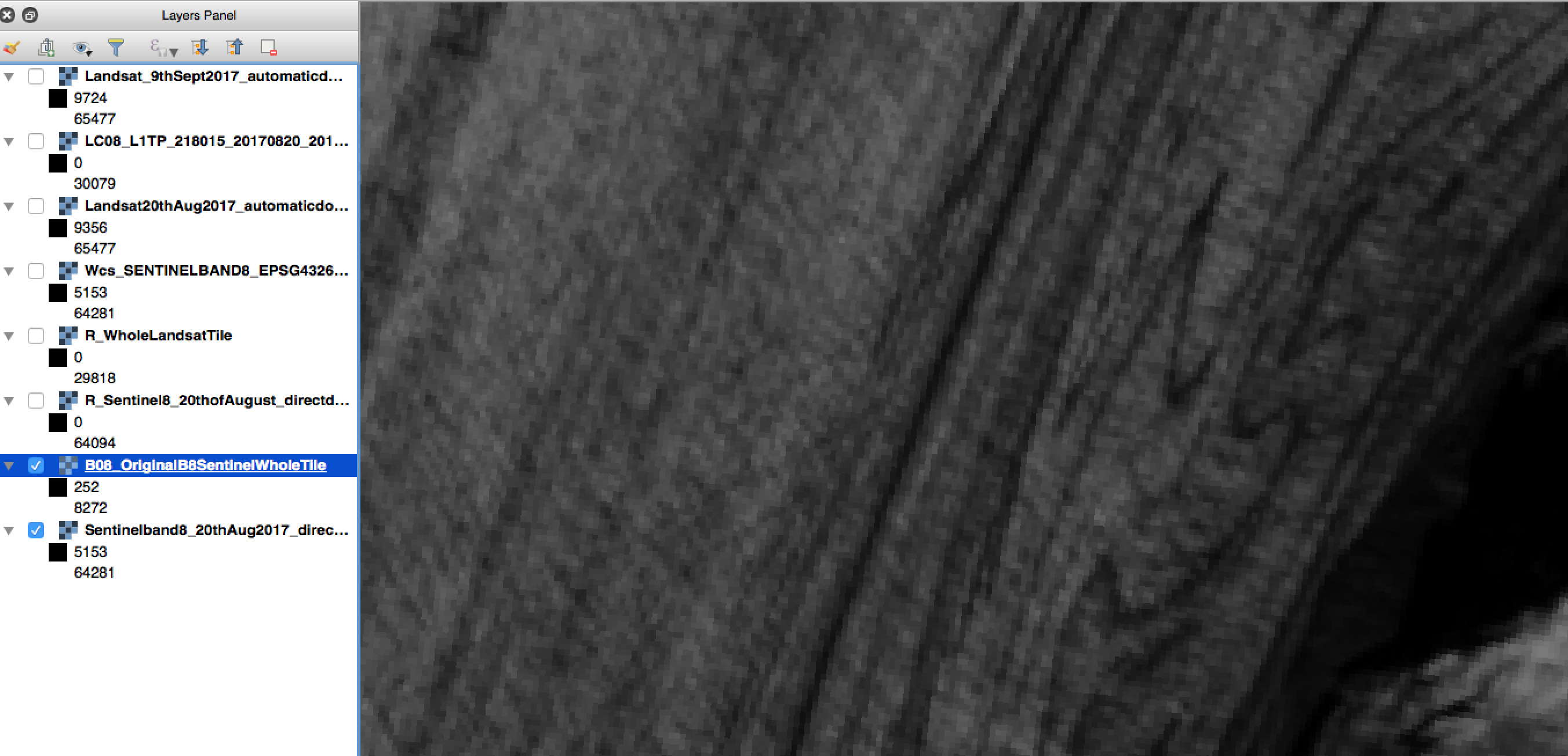
Attached are two screenshots corresponding to 1) A automatically downloaded band8-Sentinel2L1C image corresponding to my own bbox coordinates. 2) A manually downloaded whole tile (also band 8) zoomed into the same region.
What can hopefully be seen are the dirt/ash layers in ice that should run smoothly as seen ath the 2nd image. The first image has distortion in even though they are both the same resolution (10 by 10 meters) and I don’t need to perform any up or downsampling.
If you switch between the two images, the ‘‘layers’’ of distorted pixels emerge. The question is if it is still possible to download in the same quality as if done manually.
Please find the request part of my script also attached below (cannot attach as a .py file)
Am I missing something?/Is there a way to let the system know that I want no interpolation to be done to my output at all and obtain it in a raw format.
Indeed I think that is a projection issue, however I am using the only possible syntax in the script for WGS84 -EPSG 4326 (ID of this CRS), so projection should not be an issue (since my manually downloaded tile is also in CRSWGS84.
Teo
INSTANCE_ID =
import matplotlib.pyplot as plt
import numpy as np
from sentinelhub import AwsProductRequest, AwsTileRequest, AwsTile
from sentinelhub import WmsRequest, WcsRequest, MimeType, CRS, BBox
import datetime
from sentinelhub import WebFeatureService, BBox, CRS, DataSource
for source in DataSource:
print(source)
#volcano_bbox = BBox(bbox=[(-2217485.0, 9228907.0), (-2150692.0, 9284045.0)], crs=CRS.POP_WEB)
Skeidararjokull = BBox(bbox=[-17.5, 64, -16.98, 64.32], crs=CRS.WGS84) #-7.885, 38.540, -7.870, 38.560-lower left coordinate pair followed by upper right pair #-7.885,38.540,-7.870,38.560
from sentinelhub import CustomUrlParam
wcs_true_color_request = WcsRequest(data_folder=‘e8’, #comma separated at each instance
layer=‘SENTINELBAND8’,
bbox=Skeidararjokull,
time=(‘2017-08-20’),
#resx=‘10m’, resy=‘10m’,
image_format=MimeType.TIFF,
instance_id=INSTANCE_ID)
#custom_url_params={CustomUrlParam.ATMFILTER: ‘ATM’})
wcssentinelband8 = wcs_true_color_request.get_data(save_data=True)