Hello!
I want to download an image (Landsat-8) and the date it was taken. For this, I combine WMS + WFS.
The bbox I am using:
-65.01038687755037,-34.83256549540951,-64.97794366609234,-34.75317944010311
To download the image I use:
This last request downloads an image from 24/05/2021
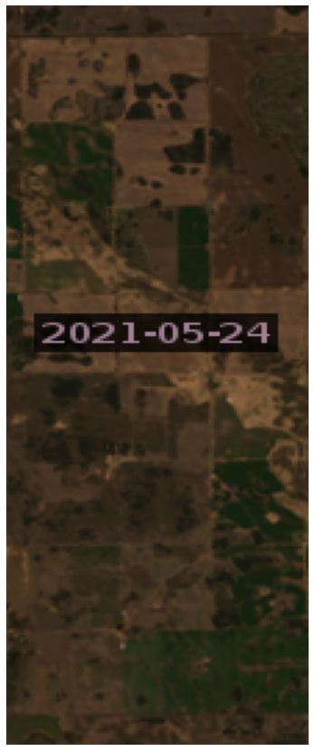
(I only know this because I requested “addiotionalData” in the layer configuration as stated here)
However, when I do the same request with WFS as follows:
I get the following:
{‘type’: ‘FeatureCollection’,
‘features’: [{‘type’: ‘Feature’,
‘geometry’: {‘type’: ‘MultiPolygon’,
‘crs’: {‘type’: ‘name’,
‘properties’: {‘name’: ‘urn:ogc:def:crs:OGC::CRS84’}},
‘coordinates’: [[[[-66.17699746759213, -35.269739550863164],
[-64.16323374467363, -35.65718908264593],
[-63.70066183727885, -33.9474911167693],
[-65.67603408145614, -33.56524292725187],
[-66.17699746759213, -35.269739550863164]]]]},
‘properties’: {‘id’: ‘LC08_L2SP_229084_20210812_20210819_02_T1’,
‘date’: ‘2021-08-12’,
‘time’: ‘16:09:29.22’,
‘path’: ‘https://usgs-landsat.s3.amazonaws.com/collection02/level-2/standard/oli-tirs/2021/229/084/LC08_L2SP_229084_20210812_20210819_02_T1/LC08_L2SP_229084_20210812_20210819_02_T1’,
‘crs’: ‘EPSG:32720’,
‘mbr’: ‘208200,6052300 438600,6284200’,
‘cloudCoverPercentage’: 0.14}},
{‘type’: ‘Feature’,
‘geometry’: {‘type’: ‘MultiPolygon’,
‘crs’: {‘type’: ‘name’,
‘properties’: {‘name’: ‘urn:ogc:def:crs:OGC::CRS84’}},
‘coordinates’: [[[[-65.70984077881769, -33.56288463216503],
[-63.73758134237661, -33.94498307026547],
[-64.19963550942893, -35.65522086337681],
[-66.21343790812278, -35.26609419694817],
[-65.70984077881769, -33.56288463216503]]]]},
‘properties’: {‘id’: ‘LC08_L2SP_229084_20210524_20210529_02_T1’,
‘date’: ‘2021-05-24’,
‘time’: ‘14:09:02.11’,
‘path’: ‘https://usgs-landsat.s3.amazonaws.com/collection02/level-2/standard/oli-tirs/2021/229/084/LC08_L2SP_229084_20210524_20210529_02_T1/LC08_L2SP_229084_20210524_20210529_02_T1’,
‘crs’: ‘EPSG:32720’,
‘mbr’: ‘205500,6052300 435600,6284200’,
‘cloudCoverPercentage’: 0.04}}]}
Which shows that there is a newer image than 2021-05-24 and WMS is not getting that one.
My question here is two-fold.
-
Why is the WMS Service not getting the image from 2021-08-12?
-
Is there an easier way to get the date from the image downloaded with WMS? The “addiotionalData” could actually add the requested data as metadata and not print it on the middle of the image…
Thank you very much,
Uriel