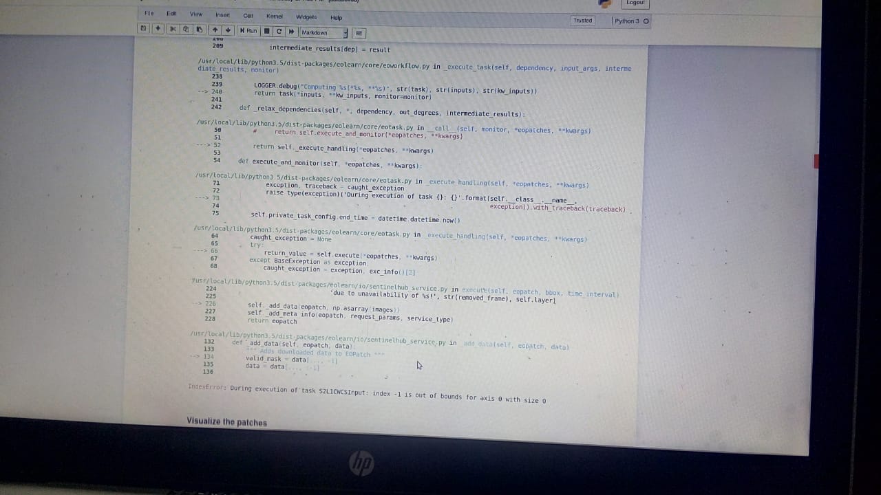
I am getting this error while downloading my area image. When using a shape file of my own region, generated via “SI_LULC_pipeline.ipynb” notebook…
also i found similar issue /here …Anyone knows how to handle this problem…Many Thanks in advance!
Hi
I’m looking for the changes in this Notebook file…can you please suggest me what changes i should make so i can get pune images from Notebook file…and if i did changes in the notebook file I’m getting error… Thanks
To run the notebook for a custom area you would need an input polygon defining your region-of-interest (e.g. Pune), and labels to be used to train the machine learning algorithm. The input bounding box can be hard-coded to the coordinates of Pune.
Do you have labelling data available for Pune? If yes, which format is it?
For pune i tried to find the input polygonal…do you have any idea where i can find the polygonals for pune…or do you have available for another city in india…need your help… Thanks
Hello @devis.peressutti
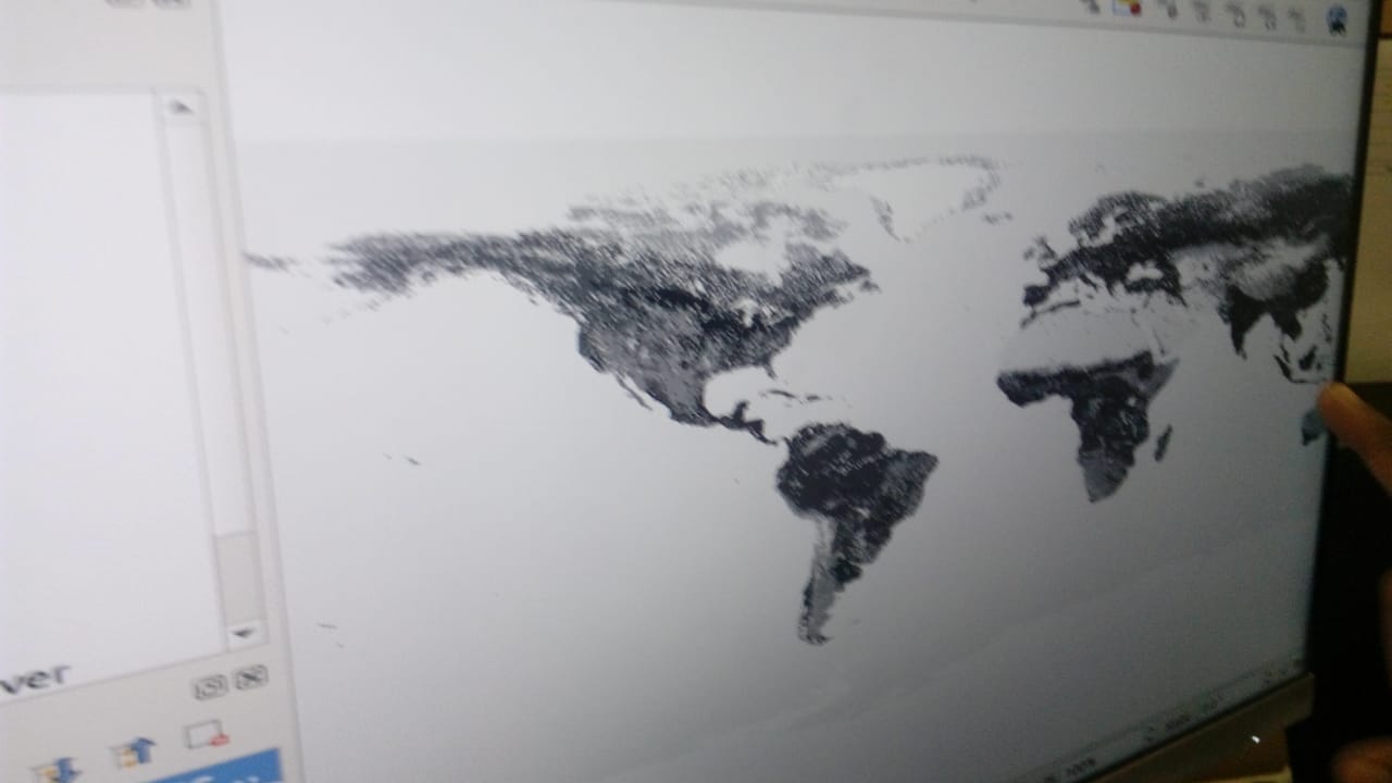
Actually after getting your reply started searching on it…i found this link
helpful and downloaded image from herebut image size was heavy so it took time…so i am requesting you for help in the next part where i am stuck…also my subscription is over as i’m student do you have any idea for renewing subscription or students plan…i am very thankful to you!
Hello @devis.peressutti
Actually after getting your views on it, i started searching on it…i found this link
helpful and downloaded image from [here] (ESA/CCI viewer)but image size was heavy so it took time…and all bands are not covered you can check
…so i am requesting you for help in the next part where i am stuck…not able to find right image…if i am doing something wrong please help me…i am very thankful to you!