Issue with shape of the polygon

Hello,

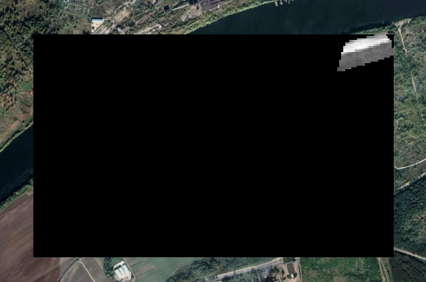
I have downloaded Sentinel-s2-l1c data using below geojson coordinates but it gave 1/4 part of the image for some dates (2019-09-06, 2019-08-23, 2019-08-22)

{
  "type": "FeatureCollection",
  "features": [
    {
      "type": "Feature",
      "properties": {},
      "geometry": {
        "type": "Polygon",
        "coordinates": [
          [
            [
              38.776009,
              55.053424
            ],
            [
              38.771718,
              55.05716
            ],
            [
              38.772254,
              55.05748
            ],
            [
              38.775473,
              55.058561
            ],
            [
              38.780966,
              55.060478
            ],
            [
              38.784871,
              55.061486
            ],
            [
              38.786631,
              55.06183
            ],
            [
              38.78706,
              55.062199
            ],
            [
              38.790278,
              55.062961
            ],
            [
              38.795686,
              55.064067
            ],
            [
              38.801351,
              55.064927
            ],
            [
              38.804398,
              55.06532
            ],
            [
              38.804913,
              55.065025
            ],
            [
              38.805299,
              55.064239
            ],
            [
              38.794699,
              55.062445
            ],
            [
              38.796244,
              55.060872
            ],
            [
              38.793068,
              55.060257
            ],
            [
              38.787661,
              55.058709
            ],
            [
              38.785043,
              55.057775
            ],
            [
              38.784056,
              55.05716
            ],
            [
              38.782725,
              55.056619
            ],
            [
              38.779421,
              55.055464
            ],
            [
              38.778691,
              55.054948
            ],
            [
              38.77852,
              55.054161
            ],
            [
              38.776009,
              55.053424
            ]
          ]
        ]
      }
    }
  ]
}

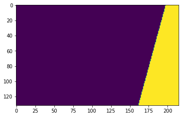
Please check the below image has an issue

Original image shape:

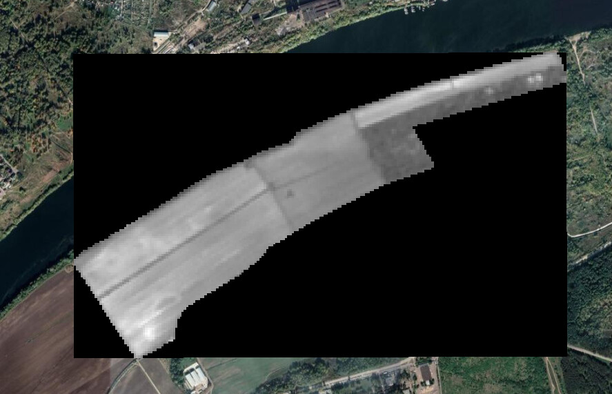
Could you please help me to get the correct shape?

Thank you in advance!

Kind Regards,
Deepika

Dear @deepika.s,

I am certain that your geometry is crossing an orbit boundary. The data mask (see docs) for 2019-08-17 over your geometry bounding box looks like this (yellow contains data, purple has no data):

dataMask

Hello Batic,

Thank you for the response!

Is there any way to get the full image in that case?
Could you please help me?

Kind Regards,
Deepika

In principle that is the whole image, at least for that particular observation (orbit).

If you’d like data for full geometry, and don’t care about the fact that pixels will have values from different dates, you can mosaic several orbits into one: you can request data from longer time period (e.g. 10 days), using mosaicking option most recent (or least cc, …). Learn more about mosaicking here and mosaicking orders here.

Hi,

Thank you for providing the solution.
But we need image values of the particular date without having the values from other dates
Is there any other way to get the correct values for missing part of the image?

Kind Regards,
Deepika

There is no data for a particular day outside the orbit swath. This video illustrates what an orbit is.

The image below shows all the Sentinel-2 tiles obtained on 2019.08.17. The red polygons are Sentinel-2 tiles that follow the path of relative orbits, and as you can see, the orbits are - due to the flight paths of Sentinel-2 satellites and due to Earth inclination - overlapping only at the most northern parts, everywhere else there is no same-day data next to the orbit.

Hello Batic,

Thank you so much for clarifying!