Hi there,
I seem to only get whole numbers between 0-10 in the bands B01, …, B07 of the Landsat 8-9 data. As an example of an RGB image (bands B04, B03, B02):
array([[[2., 9., 1.],
        [2., 9., 1.],
        [3., 9., 1.],
        ...,
        [0., 0., 0.],
        [0., 0., 0.],
        [0., 0., 0.]],

       [[3., 9., 1.],
        [3., 9., 1.],
        [3., 9., 1.],
        ...,
        [0., 0., 0.],
        [0., 0., 0.],
        [0., 0., 0.]],

       [[2., 9., 0.],
        [2., 9., 0.],
        [2., 9., 0.],
        ...,
...
        ...,
        [0., 0., 0.],
        [0., 0., 0.],
        [0., 0., 0.]],

       [[5., 7., 2.],
        [5., 7., 2.],
        [5., 7., 2.],
        ...,
        [0., 0., 0.],
        [0., 0., 0.],
        [0., 0., 0.]],

       [[5., 7., 2.],
        [5., 7., 2.],
        [5., 7., 3.],
        ...,
        [0., 0., 0.],
        [0., 0., 0.],
        [0., 0., 0.]]])
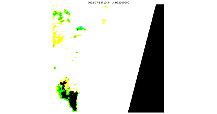
The image looks then like this:
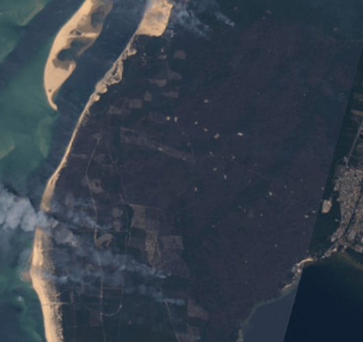
For comparison, in the playground the image looks like this:
This is on the south coast of France, 18.07.2022. To load the image above I used the Catalog to find the possible images around that time. Then I build a request via the SentinelHubRequest with the standard evaluationscript (sorry for the bad formatting, doesn’t want to get in shape)
evalscript_LA8_all_bands = """ function setup() { return { input: [{ bands: ["B01","B02","B03","B04","B05","B06","B07"] }], output: { bands: 7 } }; } function evaluatePixel(sample) { return [sample.B01, sample.B02, sample.B03, sample.B04, sample.B05, sample.B06, sample.B07]; } """
Any idea what I might be doing wrong here?

