Hello,
I have a data frame of more than 10,000+ rows. In corners, I have longitude and latitude of the 4 corners of the bounding box.
My question is SentinelHub requires us to have WGS-84 Coordinates, So how can I convert these latitudes and longitudes (of 4 corners) into WGS-84 coordinates so that I can download all the images from the data frame.
Note: I am not using the free trial version of the sentinel hub.
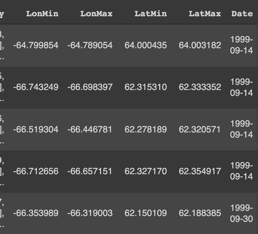
Eg. of the data I have in dataframe.
Thank you,
Hi @shivvyas303 ,
The Latitude and Longitude coordinates for a particular location will differ depending on the CRS and when the measurement was taken, and WGS84 is one of the most popular used geographic coordinate systems using latitude and longitude.
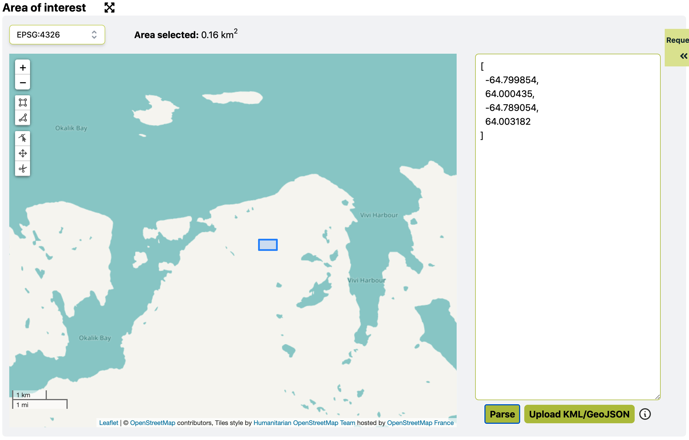
In your case it would be better to figure out what CRS is used for your data. I did a quick check for the area shown in the first row in WGS84 via Requests Builder and it seems to be located on the land between Vivi Harbour and Okalik Bay in the east coast of Canada. Does the location make sense to you?
Note that the bounding box coordinates should be provided in the following format:
[minx, miny, maxx, maxy]
Hi @chung.horng,
Thank you so much for the reply.
I am using the Randolf Glacier Inventory dataset(RGI: [GLIMS: Global Land Ice Measurements from Space]
I am kind of new to this. I have to work with Glaciers.
My main goal is to download all the images using these coordinates and sentinel hub.
Any tips or guidance will be really helpful.
Thank you,
Hi @shivvyas303 ,
I did a quick check on the website you provided and downloaded the GLIMS data (latest.zip). The shapfile of glims_polygons is using WGS84.
To make sure what coordinate reference system is used for your data, the easiest way is opening your data in QGIS and check its properties. Normally you will see the CRS and other information of your data.