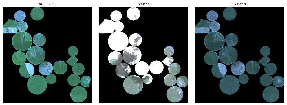
assuming that you made sure that the scenes downloaded from Sentinel Hub are from single date (I am pretty confident this is the case, but would have to see the actual requests you were making to the APi to be certain; the easiest way to check is to log-in to EO Browser, load the theme with PlanetScope data and check it visually there as well), this is probably a consequence of inaccuracies of the satellite sensor, which are not that uncommon - you will even find them with “best” Sentinel-2 satellite, albeit in lesser extent.
In case of PlanetScope, the data is acquired by multiple satellites (more than 200) and if you are in the border of two acqusitions you might indeed see such artefacts. There is no way to fix it on the data side (data are as they are), so the best way is to work around it on the modelling side. UDM2 meta-data layer often comes handy with that. But generally, the ML models work quite well, even with some noise as described in your case.
You should also take into account that Planet is improving the quality of their sensors on an ongoing basis, so it will get better and better.
Perhaps you might find this blog of interest (not the PlanetFusion part, but overall on our experience with Planet data in modelling exercises):