Hi. I am trying to download images in the analytical geotiff format at high resolution. If I try to download the same Area of Interest for instance with S2 L2A and S3 OLCI under the Coordinate system i ahve for bothe Projected resolution: 40 m/px. If I download such images and open them with a Gis Software I get the same resolution. Since the spatial resoultion of S2 and S3 are very different I wonder how could have the real spatial resolution for each satellite image?
Sentinel Hub API (either through EO Browser or directly) provides up- or down-scaling. Therefore, if you want to get real resolution, you simply need to specify the appropriate resolution.
Make sure to also use the same CRS as the original data are distributed in. E.g. UTM for Sentinel-2.
Than you for you reply. Do you mean I can change the resolution in Eo Browser or I should do this when I read the images in whatever gis software I am using?
You can do it in EO Browser to some extent, see below. But even more controlled, you can do it if you use Sentinel Hub services directly.
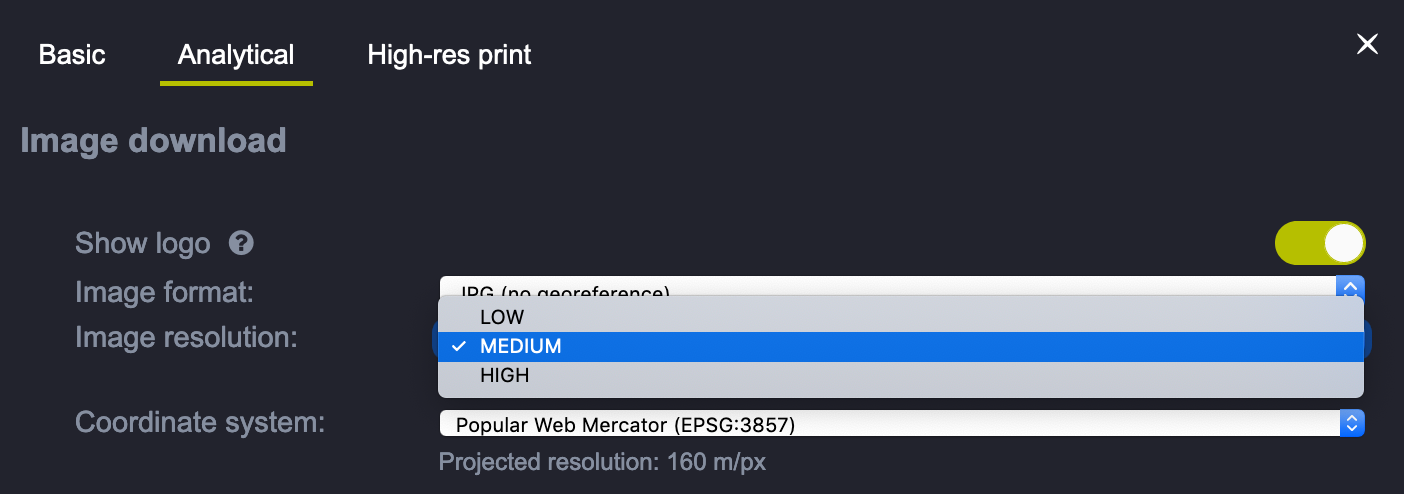
Now is all clear. Thanks. I was confused by the fact that if you want to download a Sentinel 2 or a Sentinel 3 image from the same area of interest (using EO browser) and you set the same resolution (ie high), it will show the same resolution for both S2 and S3 even if looking at the image you see that S2 has a much better spatial resolution.