If you perform a WCS request to Sentinel Hub and set it to 10-meter resolution, you will get all bands scaled to 10-meter resolution. Sentinel Hub’s response cannot return data at different resolutions.
Might it be that it just appears that they are in 20/60 meter resolution, as all the neighbouring 10-meter pixels will have the same value?
I’m not sure I understand what you mean by neighboring pixels.
I open the response.tiff file with qgis.
Every band has its original resolution (10,20,60) and not all of them at 10m which means that I now need to resample them myself.
I checked the response.tif and I am pretty certain that all bands in this file have a resolution of 10 meters. In general, all bands in the GeoTiff have the same resolution.
How do you think/see that some bands have a resolution of 20/60m? Can you demonstrate this step?
" In general, all bands in the GeoTiff have the same resolution." - That’s part of the reason I’m writing.
Make a copy of the respone.tif file. load them both into qgis with a symbology of a single band.
Then select band 1 that has 60m res, and for the other file select band 2 with 10m.
Now you turn the top layer on and off to see the pixels are of different sizes.
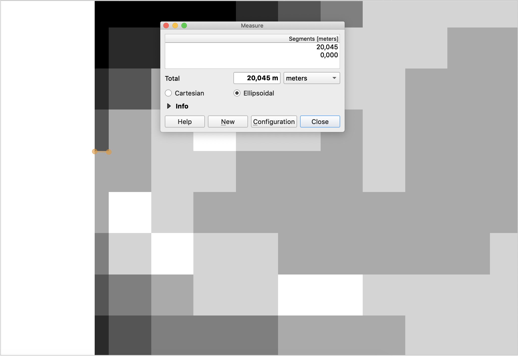
I did just that and I am still confident that all the bands are in 10 meter resolution.
It probably appears that e.g. B1 is in 60m resolution for a simple fact that 36 (6x6) 10-meter pixels have exactly the same value (as expected, these values are upscaled from 60m pixel), so they appear larger.
If you look at the border of the BBOX, you will actually visually notice some smaller pixels, as your BBOX does intersect with some 60m pixels only partially.