I notice that the Sentinel-2 images for Norway in EO-browser, this time of year seem to have a layer that masks what looks like areas that are effected by shades from the mountains. Is it possible to turn this off?
My main interest for using these images is to explore ice-cover on lakes of recreational purposes (skating). We inspect the images visually and the shading makes the images harder to read.
Thanks for the question, I assume that you are looking at the Level 2A imagery in EO-Browser. Unfortunately, this shading effect is an artefact of the atmospheric correction algorithms used to preprocess the imagery. If you use the Level 1C imagery you can see these areas are extremely dark as they will not be receiving any direct sunlight meaning that very little light will be detected by the sensor during acquisition.
This post from GIS Stack Exchange actually explains how pixel quality at high latitudes is affected by the long shadows that occur during the winter months when the sunlight hours are limited.
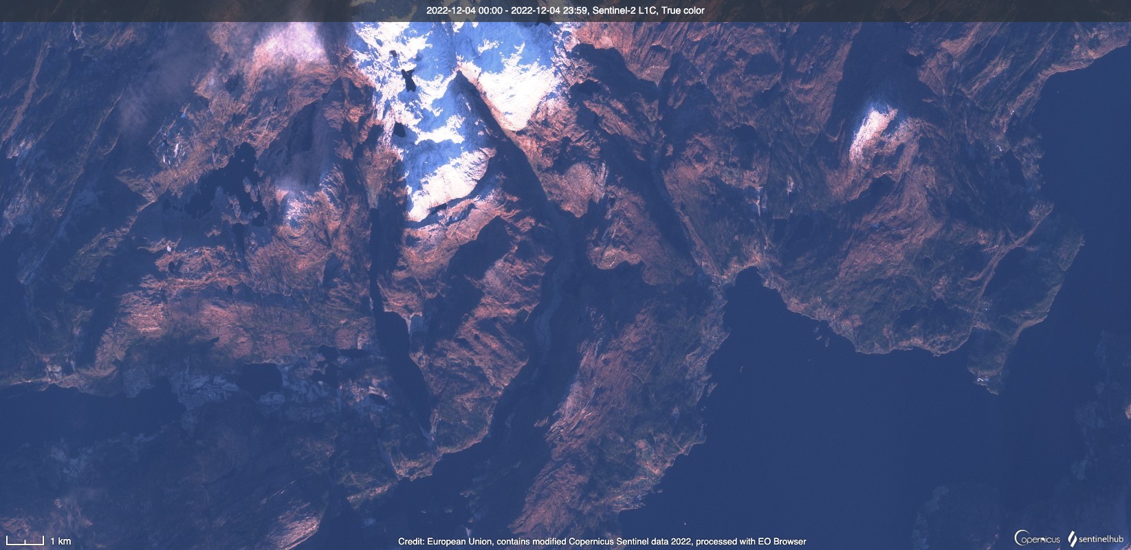
Below is a comparison of the same area of interest with Level 1C which you can see is very dark.
and Level 2A where the areas in shadow are lighter but also hazy after the atmospheric correction. It’s important to note these areas are classified as topographic casted shadows in the Scene Classification Layer. Therefore, while the pixels might be okay for visual interpretation, for scientific analysis they would not be.
Hi William,
Thanks for a very clear answer. We only use the images for visual inspection and can see what we need even if the area on the image is very dark.
Leo