Hi Guys
I am trying to learn to work on sentinel-hub,
I have a case where I want to know the water level is down in a lake,
When I take pictures of a lake at different times, using NDWI, I see white color,
Does this reflect the receding of water from this region at this time?
I mean the white color on the ends in these pictures as an example:
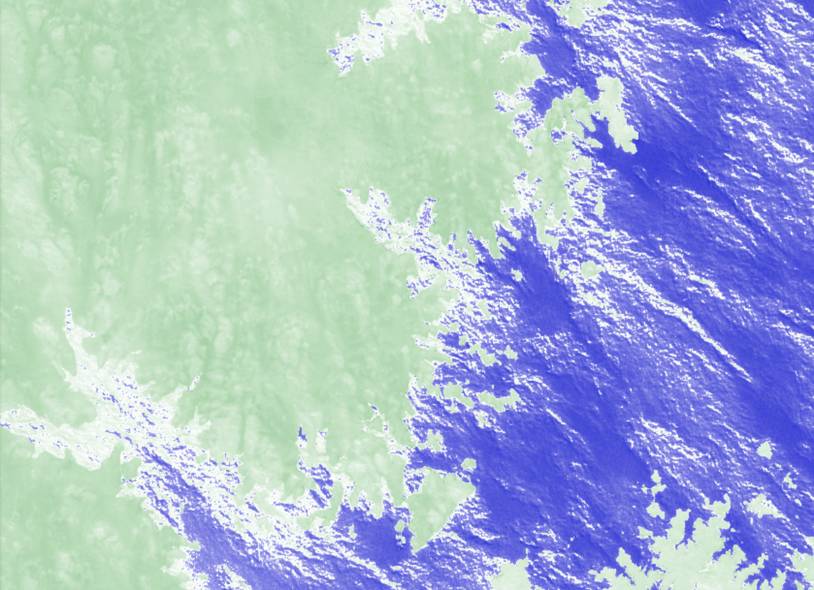
Hey @solimani,
welcome to the sentinel-hub forum!
Your idea of using the NDWI for determining the water level is a good approach but the white color doesn’t indicate receding of water.
How do indices work? You combine different bands to calculate a new values for each pixel that you can then use for identifying certain features. In the case of the NDWI and your image, low values got colored green indicating no water, high values got colored color indicating water. Values in between (~ 0) got colored white. Ergo the white color doesn’t mean receding water but values that are not water (blue) but something else.
For extracting the water level at different time’s I suggest you to do a bit more research on what is a good threshold for determining water with the NDWI, test and modify it for your area and then apply this on all images. To get the changes in the water level you need in a last step then compare your images from the different time steps.
A general tip for using the forum:
It’s always helpful for other’s if you give some more info on which steps you did/script you used to get to your results (in this case the image) 
dthiex