I have two questions.
The first is: Can I create a custom evalscript so that I can access via WMS call? That is, save my evalscript in the EO Browser and call it through a WMS request? I didn’t find documentation that taught me how to save these evalscripts.
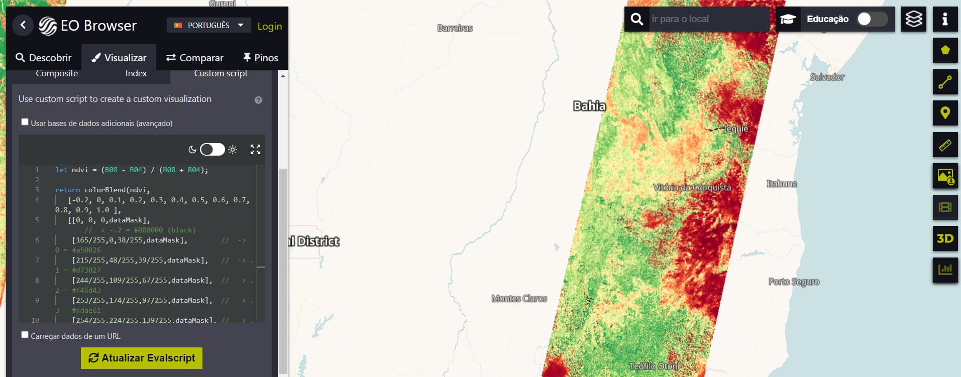
Second question: I’m testing my Evalscript and I need images of Brazil, however, I don’t have images of the entire country, as you can see in the image, can anyone explain to me why?
You can indeed store the evalscript in the WMS configuration, see these instructions:
The image shown is the data acquired on a selected date - typically you see one orbit. You can extend the temporal period as shown in this blog (search for “Advanced control of time intervals”
I don’t have a good command of English, and because it is a very specific subject, this makes my research difficult. I’ve been reading the documentation for two weeks and haven’t found an answer to my questions, so I opened this question here on the forum, to see if anyone can help me more directly.
Thank you, I was actually able to register evalscript and use it on my website with a call to Google Maps, exactly as I wanted.
1 Like
This topic was automatically closed 60 days after the last reply. New replies are no longer allowed.