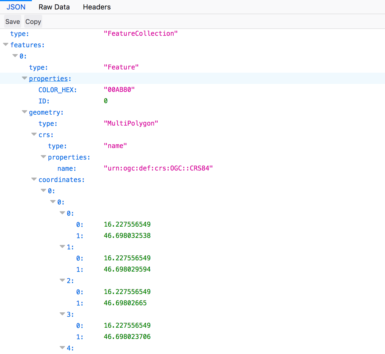
Some of our users wanted to get vector output from our services, so that they could e.g. get zone map of the parcel. We have now added this feature, e.g. (one should replace <INSTANCE_ID> with her own):
http://services.sentinel-hub.com/ogc/wms/<INSTANCE_ID>?SERVICE=WMS&REQUEST=GetMap&SHOWLOGO=false&VERSION=1.3.0&LAYERS=NDVI&MAXCC=20&WIDTH=640&HEIGHT=640&CRS=EPSG:4326&BBOX=46.697956,16.223885,46.699840,16.2276628&FORMAT=image/jpeg

http://services.sentinel-hub.com/ogc/wms/<INSTANCE_ID>?SERVICE=WMS&REQUEST=GetMap&SHOWLOGO=false&VERSION=1.3.0&LAYERS=NDVI&MAXCC=20&WIDTH=640&HEIGHT=640&CRS=EPSG:4326&BBOX=46.697956,16.223885,46.699840,16.2276628&FORMAT=application/json
application/x-esri-shape is also possible output