I have just signed-up for an Explorer Subscription. Little did I know that after subscribing, the 10m image resolution I can get from Sentinel is completely useless as it is so poor/blurry. I suppose I have to pay even more money to get useful resolution from commercial data. Question is what resolution would I need to buy to be able to at least recognize the image of a regular car size? (or equivalent to Google Map’s resolution).
Hello Dennis,
Yes Sentinel-2 imagery is a maximum 10m and is the highest resolution imagery that is non-commercial.
To be able to identify individual cars from satellite imagery you would require data from one of the following:
- Planet’s PlanetScope data
- Planet’s SkySat data
- Airbus’s Pleiades data
- Maxar’s WorldView data
You are right that to use this data you do have to purchase it in addition to your subscription. You can find out more about our commercial data offerings here and here. Please let us know if there is more that we can help you with.
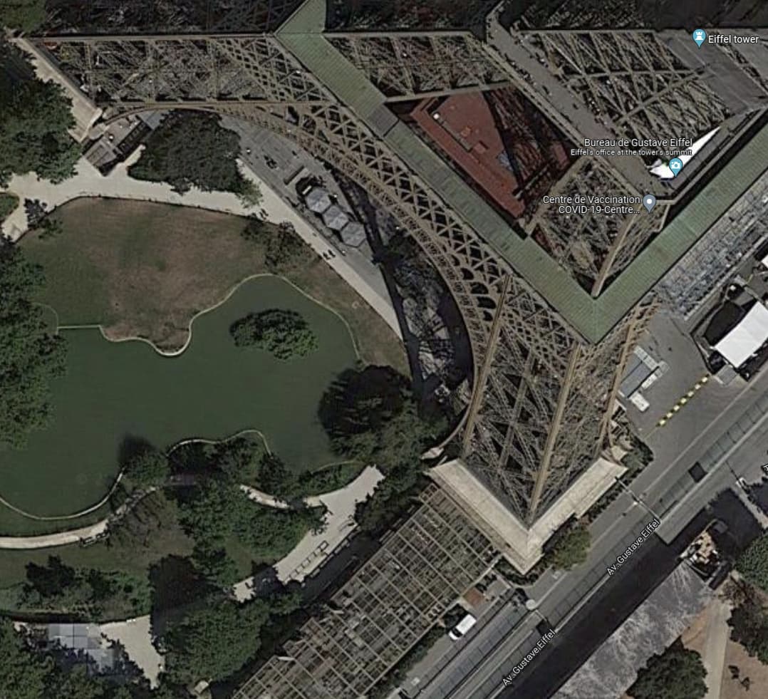
Hi William, the commercial data at 2m or 3m resolution is just 5 times better than 10m resolution. Please refer to this screenshot I see for Eiffel Tower in Paris at 10m resolution. Will 5 times more resolution really be good enough to match Google Map’s resolution? Do you mind showing me a sample of this scene in 2m resolution?
Hi Dennis,
If you read the documentation, using the panchromatic band, you can achieve resolutions of 0.5m with some of the commercial satellites that were mentioned above. There are some examples on our Flickr account that you can look at.
Hi William,
I read them. It is still very difficult to tell. Can you comment on this Google Map image of Eiffel Tower. What resolution would this be, to be able to see a car/van next to it? I need the equivalent from Sentinel Hub.
Hi, I cannot tell you for the certain but the image you are referring to is probably about 30cm resolution but I am nowhere near certain of that. In addition, looking at Google Maps myself the attribution to the imagery at that resolution refers to aerodata international surveys who appear to be an aerial photography provider. Aerial photography produces very high resolution imagery better than satellite imagery so your request may not be possible.
Are you trying to identify vehicles algorithmically or just visually? If you are using the data for object detection then the slightly lower resolution of satellite imagery is almost always sufficient.
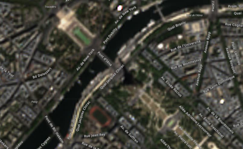
Hi William, yes, I also think that would be under 30cm resolution. Google map’s resolution is that good everywhere I checked. My neighbourhood where I stayed is available in that high resolution, and I doubt it’s worth any special aerial photography for Google to take it. See this example of Narita airport, anyway. Anyway, is it possible for you to just show me any random photo of 2m resolution? The link you sent previously in Flickr is not zoomed in enough to see a car size object. On your question on algorithm or visual inspection, what I asked was just an example. I am just doing investigation/exploration currently.
You can test out some examples of Pleaides imagery here. This should give you a good idea of whether this resolution is sufficient for your purposes.
There are also examples for Maxar imagery and Planetscope too.
Hi William, thanks for the info. I haven’t learned how to do this. Can I actually request for an image from Pleaides, Maxar, Planetscope without a subscription to them?
You can request these certain examples without a subscription.
Hi William, this is the best (at 3x zoom) I got from Maxar/Worldview. It is quite far from Google Map’s resolution. I guess I won’t pursue further then. Thanks for your prompt assistance.
@denseeks Maybe still worth to mention (and one reason where the divergence in resolution comes from) is that with the commercial data on Sentinel-Hub you get recent and regularly updated images whereas the rgb images on google maps are update much less frequent with a lot of images being between 1-3 years old.
Hi Daniel, yes, Google Map is actually too old for my use too. I wonder though, why the commercial data which are up-to-date cannot match Google Map’s resolution. It would be great if Google can sell up-to-date map data too ![]()
Honestly I was hoping for better than Google earth imagery, i only need a small area but extremely high resolution. Maybe I should try aerial photography instead ? Im trying to identify a certain type of plant that grows around my area .
Hi James,
Yes if you require extremely high resolution imagery (<50cm), it is best to use aerial photography. If trying to identify an individual species, you’ll also require NIR data too, as it is unlikely RGB imagery will be sufficient for this. (All this depends on the application and individual use case)
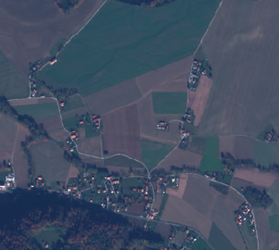
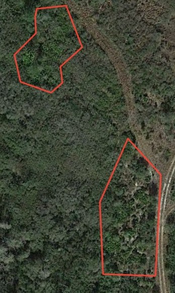
Actually the plant species im looking for Shows up like almost no other kind . Im thinking possibly a wavelength specification might work. Attached is an example . This is with a so so sat picture.
This topic was automatically closed 60 days after the last reply. New replies are no longer allowed.