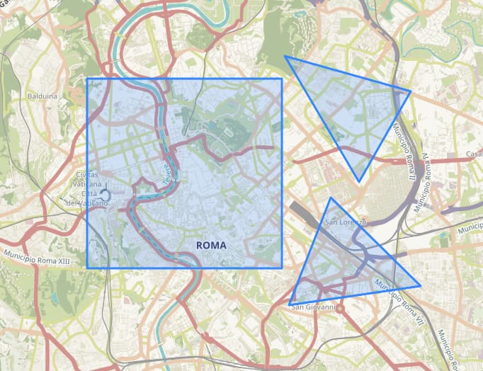
I’m wondering if it is possible to display the result of multiple polygon instead of just 1. From this polygons, I am expecting to get all 3 to be displayed,
You are able to return data for multiple polygons using Process API. However, looking at your result, I think you are requesting a OGC API WMS layer, is that correct? If so, then WMS does not support multiple outputs. This service only supports single feature polygons.
Yes, I am currently in the process of learning how to correctly set up my WMS request.
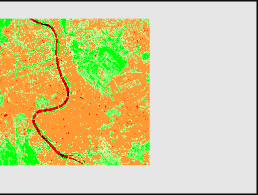
I have a follow-up question regarding the output of the request. I have applied a data mask in the evalscript. My objective is to obtain an NDVI image only within the polygon. However, the result of the request appears like this:
I had assumed that the black area outside of the polygon would be automatically cropped from the result. However, it seems that is not the case. Could you please confirm whether the output includes the entire area or if there is a way to crop it to only display the region within the polygon?
Yes, this should be no problem. I’m not familiar with the evalscript you are using but you can use a dataMask for areas of no data. There’s some information on this in our documentation.
If you wish to share your evalscript, then I can help you in integrating this into the evalscript.
OK then this is related to the display settings you are using in ArcGIS. I don’t have a license but using QGIS, you can set the No data value as 0 in the layer symbology and this will remove the black area for you. I’m sure there is an equivalent setting in ArcGIS.