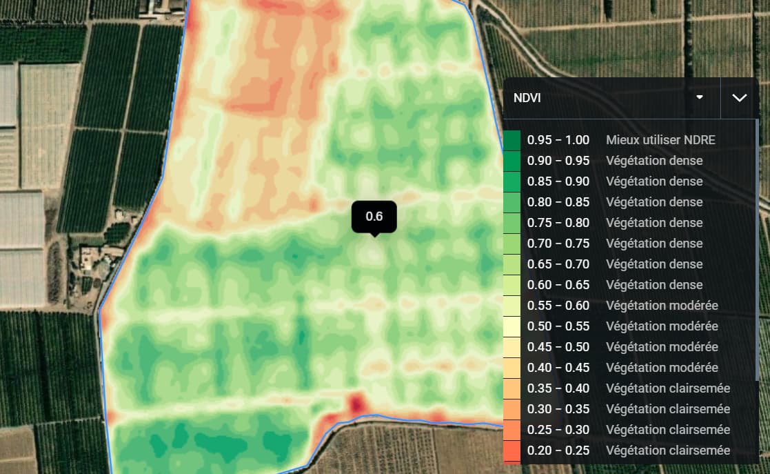
so I am using WMSLayer and I have successful placed my clipped image on the map but I want a situation where when I hover most preferred or on click I get the ndvi, ndwi or savi value of image layer
Here is my evalscript that I am using in my OGC.
//VERSION=3
//This script was converted from v1 to v3 using the converter API
//NDVI EVALSCRIPT
if (dataMask == 0) return [0,0,0,0];

//ndvi
var val = (B08-B04)/(B08+B04);
return colorBlend(val, [-0.2, 0, 0.1, 0.2, 0.3, 0.4, 0.5, 0.6, 0.7, 0.8, 0.9, 1.0 ],
[[0, 0, 0], // < -.2 = #000000 (black)
[165/255,0,38/255,1], // → 0 = #a50026
[215/255,48/255,39/255,1], // → .1 = #d73027
[244/255,109/255,67/255,1], // → .2 = #f46d43
[253/255,174/255,97/255,1], // → .3 = #fdae61
[254/255,224/255,139/255,1], // → .4 = #fee08b
[255/255,255/255,191/255,1], // → .5 = #ffffbf
[217/255,239/255,139/255,1], // → .6 = #d9ef8b
[166/255,217/255,106/255,1], // → .7 = #a6d96a
[102/255,189/255,99/255,1], // → .8 = #66bd63
[26/255,152/255,80/255,1], // → .9 = #1a9850
[0,104/255,55/255,1] // → 1.0 = #006837
]);
please I am new to this and I will appreciate a detailed walk down of the process please
here is the end image that i want:
Thank you ![]()
